I intend to walk every street in Birmingham. This will include every road (excluding Motorways and similar), canal towpath, public footpath and bridleway.

13 August 2016

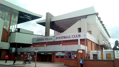
Aston Villa 3 - Rotherham 0

Back to work today or more accurately, to night.

I decided to walk in to work and then catch the bus home in the morning.

From the M6 / A452 junction, I walked past Spitfire Island and continued up past The Tyburn House until I reached The Bagot Arms, where I turned left onto Tyburn Road. Strangely, The Tyburn Road doesn't go past the Tyburn House pub!

At the junction of Tyburn Road and Kingsbury Road (which DOES go past The Tyburn House), I chose the latter, heading towards the city centre.

Nearing Gravelly Hill, I skirted around to Brookvale Park. The park, which opened in 1909, utilised the lake, from which the park gets it's name, as an open air swimming pool. The swimming (officially) ended in 1926 but the park still has plenty to offer including a bowling green, tennis courts and children's play area.

I followed Park Road, which became North Park Road around the Brookvale estate, popping out on Brookvale Road, opposite Witton Cemetery.

I turned left, here, and proceeded towards Witton.

As I passed under the M6, I noticed that there were quite a few people moving towards me. As I approached the crowd, I noticed that most were clad in the claret and blue of Aston Villa. Then it dawned on me - The Villa had been playing at home.

I made my way upstream through the throng wondering what the final score was - none of them looked particularly happy!

After passing the queues at Witton railway station, the crown thinned with just a few stragglers milling around by the time I got to Villa Park.


From the stadium, I walked to Lichfield Road which I followed through Aston, before heading to Nechells and Duddeston Manor where I stopped to grab a bag of chips before a more leisurely stroll for the final mile to work.

After a shower and change of clothes, I checked the internet to discover that Aston Villa had beaten Rotherham 3-0. With a score like that, I'd have expected to see more smiles on the fan's faces. I'd hate to see them when they lose !!!

12 August 2016

On the Cut

Another walk to Oldbury.


Started at the same point as yesterday but set off along Woodcock Street past what I remember as Woodcock Street Baths but is now called The Sir Doug Ellis Woodcock Sports Centre. Many a Saturday morning was spent splashing around here, back in the day, in my mis-spent youth!

After a short diversion where I found love (Love Lane, that is), I was walking along the towpath of the canal heading for Gas Street Basin.


After passing under the telecom Tower and climbing a number of locks, I noticed another Monopoly location...


After a few more locks, I was facing the Sealife Centre , where I turned left for the Birmingham & Worcester Canal.

The canal was followed, paralleling the newer railway past Five Ways, University and Selly Oak stations.

I did spot THIS useful sign by the university...


Soon after sighting the Cadbury complex, I was to leave the canal and head off through the quaint village of Bournville to Northfield.


From Northfield, my route took me, initially down but then slowly up through Weoley Castle to reach the Birmingham / Warley border at Hagley Road.


10 August 2016

Soho Road

My other half was working in Oldbury so I arranged to meet her after work which meant that I had a good excuse to walk West of the city centre.


Getting off my bus a couple of stops before the terminus enabled me to fill in a gap along the A47 as it passes Birmingham Metropolitan University.

From here I made my way, past the old fire station and St. Chads Cathedral, one of 3 cathedrals in the city. St. Chads, at the foot of Old Snow Hill is the Roman Catholic version whilst St. Phillips (C of E) and St. Andrews (Orthodox) make up the triad.


I continued up Old Snow Hill which becomes Constitution Hill before changing again to Great Hampton Street.


Glancing skyward (which is a great idea as so much architecture can be missed) I spotted a pelican perched on a roof. Apparently, the building under the pelican used to belong to T. Wilkinson & Sons, electroplaters whose company logo was, you guessed, a pelican. The company moved away a long time ago but the bird remains.

Great Hampton Street becomes Hockley Hill becomes Soho Hill becomes Soho Road. As the road changes names, there is the magnificent Guru Nanak Nishkam Sevak Jatha, Sikh Temple which covers 25,000 square metres, including over 100 rooms for followers to stay for the night.


Further along I passed The Rhodes Alms Houses, erected in 1871 to accommodate 16 ladies in reduced circumstances. The buildings are still used in the same way, now being sheltered housing.


After passing churches, sikh temples and mosques, I came across the Chùa Từ Đàm, Buddhist Temple. All those religions in only a couple of miles!


After another change of name (Holyhead Road), I turned left along Middlemore Road reaching the boundary with neighbouring Smethwich.


9 August 2016

Car Service 2 (the other car)

It was a little over a month ago that I had to drop the wife's car in for a service. During the service, I took the opportunity to go for a little walk (17 miles).

Today it was the other car's turn and I duly drop it off at Lookers, Star City, around 8am.

By 08:05, I was on the road.

I was hoping that the service would be about the same duration as last time and so had devised a route of around 16 miles. However, the car wouldn't be ready until two-ish so I needed to add a few extra miles. The easiest was was a diversion along the canal.

A short walk took me past Star City and under Spaghetti Junction, where I joined the Tame Valley Canal.

Just as I was about to emerge from beneath the concrete of the Gravelly Hill Interchange, I passed a memorial to D.C. Michael Swindells.

Detective Constable Michael Swindell was stabbed to death, in 2004, as he pursued a suspect who had been threatening the public with a kitchen knife.

The memorial stone was erected by the Police Memorial Trust in 2008.

On reaching College Road (A453), I left the canal (for now) and came back on myself along Moor Lane passing the massive Witton Cemetery.

Moor Lane ended at Brookvale Road, part of the Outer Circle ring road. Europe's longest bus route, the number 11, runs along here as part of it's 27 mile circumnavigation of Birmingham. Between 2013 and 2016, the number 230 in Coventry held the record but since 23rd July, the number 11 has regained it's rightful title.

From Stockland Green, I took a few roads through Perry Common ending up on the Kingstanding Road, heading North to Kingstanding (no surprise there) and thence to Sutton Coldfield.

It was somewhere on my way to Kingstanding that I passed what must be a Reliant fan with DEL 1 on the driveway.


After climbing up out of Kingstanding and making my way out of a cul-de-sac, I responded to a man out cutting his hedge who commented on my brisk walking. I explained my mission and, surprisingly, he never asked the usual "why?". After a brief chat, I was, again, on my way only stopping when I got to the boundary with Walsall.

It was about turn, to walk alongside Sutton Park, firstly along the A452, Chester Road and then Monmouth Drive.

Wyndley Sports Centre was soon passed as I ascended to the town hall before making my way to Holy Trinity Church sat on top of the hill overlooking the town.

From here, I followed the main Birmingham road through  Wylde Green and Erdington before returning to Spaghetti Junction. I did spot a very patriotic, Arriva, bus along this stretch...


It was still a good hour or so before the car would be ready so after a quick shufti at the map decided on a bit of to and fro-ing around Witton filling in a few gaps.


It was nearly time to pick up the car, so I made my way back towards Star City, stopping off for some nourishment at a chippy I'd spotted a couple of weeks earlier.

Just as I was finishing my dinner, the garage phoned telling me that the car was ready for collection - what excellent timing.

Twenty plus miles done and the car serviced for another year - what a great day!


7 August 2016

Every Little Helps


During an earlier session around Shard End (Aug 1st 2016) I'd, somehow, managed to miss this little road (Shepherds Standing) so stopped off on the way to work to walk it.

That's all !

3 August 2016

Have You Just Walked Past My House ?


A bit of a jaunt, today, starting in the bottom, left-hand corner, on the Birmingham / Worcestershire boundary.

I caught the 47 bus from Birmingham City Centre getting off at Cofton Park.

Trying to walk as close to the border as possible, I diverted from the main Groveley Road to the more suburban Nuthurst Road along with it's, mainly, uphill cul-de-sacs.

At the end of Nuthurst, I turned right onto Longbridge Lane and headed away from Longbridge itself.

As I was sauntering up and down one of the cul-de-sacs, I felt a buzzing in my pocket. "Let me just whip this out!" I said to myself, with a nod to Blazing Saddles.

I answered the phone and was greeted with, "Have you just walked past my House?"

"It depends on where you live?" I replied.
I was told.
"I think so" I answered.
"Cuppa?" - well it'd be rude not to !

After a short backtrack, I was sat on the sofa of a work colleague (let's call him - Ashley) enjoying a cup of coffee.

Eventually, I had to tear myself away and resume my patrol of the border.

Redhill Road had to be walked until the border where I turned around and headed back. Unfortunately, the last half a mile of this road is devoid of footpaths.

It amazes me that motorists think it fun to drive as close to pedestrians as possible when there are, usually, three car widths to choose from. I wonder how many of these drivers would like to have a ton of steel moving at 40+ mph pass within inches of them? Knobs !


Back on the pavement and feeling a little less vulnerable, I retraced my steps passing the Birmingham City Football Club's training ground.

Deep below the all weather pitches, runs the Birmingham & Worcester canal, through the 2,726 yard long Wast Hills Tunnel.

After a short stretch on the Redditch Road, I turned right onto Longdales Road - with the emphasis on the long.

Longdales Road, encompasses the Hawkesley Estate becoming Icknield Street and finally Walkers Heath Road (from where I set off yesterday).

Instead of heading back into Birmingham, I continued along the border along Druids Lane, skirting around, the appropriately named, Druids Heath before arriving at The Maypole.

From here, it was straight (apart from a couple of cul-de-sacs) up the Alcester Road to Moseley where I had arranged to meet the other half after work.

A good ol' walk , covering 25.2 km (about 16 miles in the old money).


2 August 2016

Monopoly

My other half was working in South Birmingham so I cadged a lift to Walker's Heath (appropriate or what?).

I planned on walking to the city centre which would be mainly along the Pershore Road.

First job of the day was to walk the few residential roads adjacent to my drop off. Strangely, the Birmingham boundary (shown blue on the map) doesn't follow any feature but goes straight down bisecting some of the roads. This results is next door neighbours, one in Brum and the other in Droitwich.

The boundary usually follows some prominent feature, be it a river, field boundary or road. Often the line runs down the middle of a road so that I have to make sure that I walk on the correct side !
With Chelworth done, I proceeded North, along Broad Meadow and Lifford Lanes before reaching Pershore Road where it crosses the Birmingham and Worcester Canal.

About a mile along the A441, I came across the 'new' King Kong, above a carpet shop.


The original Birmingham King Kong stood in the centre of Birmingham for a few months in 1972.


Kong, a 18 foot tall fibreglass statue, was on loan to the city but the council declined the offer to buy it and it was sold to a local car dealer for £3,000. After being used to advertise car dealers around Birmingham it was shipped off to Edinburgh and was last seen, recumbent, in Penrith.

Just past the (new) King Kong the Pershore Road splits for a short one-way section near to Stirchley Public Baths which opened in 1910.

Going along the right hand side of the split (Pershore Road) I turned off to walk Hazelwell Lane but was confronted with this..


Apparently, this is the site of the new Stirchley United football ground. I may need to come back to Hazelwell Lane to walk the rest of the road, once the roadworks have finished.

Coming back on my self on the other side of the split (Hazelwell Street) and passing the baths, I came across three roads which will be familiar to anyone who has played Monopoly.

At first, I thought that they were named after the Hasbro board game but looking at the architecture, especially the date of 1900 over the one time Bournville Market, it would appear that these roads were just named after the prominent shopping areas of that there London.

I bet a house here would cost more than £200 though !


After a stroll around 'London' it was a fairly straightforward stroll along Pershore Road grabbing a few of the many cul-de-sacs along the way.

2 July 2016

Car Service

I had to drop the wife's car in for a service today so I planned on walking home from the Garage then returning once the service was complete.

I planned a couple of routes and drove to Lookers near Star City, leaving the car a little after 8. I was told that the car would be done by 12 which gave me time to walk home, grab a coffee and then I'd be out again.


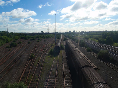
First port of call, was Washwood Heath Sidings. Built for the Midland Railway from 1877, this marshalling yard was enlarged over the years. 


After a short, cul-de-sac excursion up Wolseley Drive,  for another view of the former LDV, I was at the site of the former boozer, The Bromford. After standing derelict for some years, the building has been demolished to make way for some shops with flats above. 

From The Bromford, I made my way up Bromford Lane, past the Police Station, to The Fox and Goose. I backtracked, slightly, to Brockhurst Lane. This led to Bromford Road and thence to Collingbourne Road.

On reaching Chipperfield Road, I turned down Kempson Road (named after the racecourse). After a few twist and turns I was at The Clock garage where I planned on catching the bus home for my coffee break.

Looking at the display on the bus shelter, I was informed that the next 94 would arrive in 14 minutes. In my head I calculated when I'd get home and when I'd have to depart and decided to keep on walking, joining up with my original route at the aforementioned Fox and Goose.

The route to the Fox and Goose was almost entirely along residential streets with a brief bit of greenery at Hodge Hill Common, where a narrow path connects Stetchford and Coleshill Roads.

From the Fox and Goose, opposite which used to be the Beaufort Cinema, until it's closure in 1978, I continued along Washwood Heath Road.


On the approach to the shops at Washwood Heath, there is a newly erected 20 MPH sign. The road in front of the shops is a bit of a free for all, with cars parked willy-nilly, on the road, the pavement and even the zebra crossing. Instead of sorting out the traffic the council have slapped on a speed limit.


The shops themselves are a mixture from around the world with England, Pakistan, India, Turkey, Poland and recently Romania represented.

I finally left the B4114 on Aston Church Road passing a number of scrap metal dealers before arriving at the best known, Taroni's.


There is a road leading off Aston Church Road which doesn't appear to have a name. Google Maps has no name for it, neither does the AtoZ. Locally, Taroni has adopted it and named it - you guessed - Henry Taroni Avenue. There's even a sign.


It was around this point, that the garage phoned to tell me that the car wouldn't be ready until 12:30. I recalculated my route to include a bit of Birmingham's famous 'more canals than venice' waterways.

At the end of the A47, Heartlands Parkway, I crossed Saltley Viaduct going over, the River Rea, the Birmingham to Derby railway and the Grand Union Canal before reaching one of Brum's least attractive streets (no names, no pack drill). 

Fortunately, this was short lived and I was soon on the much more attractive canal.


Back at Aston Church Road, I left this canal and proceeded to the Birmingham and Fazeley canal in Aston. From here I went under Spaghetti Junction and back on to the Grand Union, passing Star City on my left. 


This time, on arrival at Aston Church Road, I made my way, once again, to Heartlands Parkway for a short walk, past the site of two huge gasometers, now demolished, to pick up the car from Lookers.

In total, I walked 17 miles covering a lot of previously un-walked Birmingham roads.

1 July 2016

Moseley Street

Just a quickie today. I had arranged to meet the other half in Moseley a little later so only had time for a short walk. I planned on catching the bus to Moseley so devised a route from work to a number 50 bus stop - in this case, Moseley Road.

My mini-route started along roads that I'd previously walked and it wasn't until I reached Bradford Street that I was in new territory.  From Rea Street, I walked back towards the markets before walking along Barford Street until I reached Moseley Street.

Moseley Street runs uphill, parallel to Cheapside and Bradford Street, ending at Moseley Road.

Towards the end of the street was this find building ...


This Victorian building was built around 1880 and is now a Grade 2 listed building. Formerly barracks for the Birmingham Police Force, it is now St. Anne's Hostel which takes in homeless men.


Further up the hill is Cleary's. One of the city's many Irish pubs, it is resplendent in it's yellow and green livery.

From Cleary's it was but a few metres to Moseley Road and the bus stop.

20 June 2016

Digbeth

Nothing too exciting, today.

I finished work around 5 and took a circuitous route through Digbeth, ending up on Bradford Street where I caught the bus out to Moseley to meet the wife from work.

Walking along Bromley Street, I spied this excellent piece of monochromatic graffiti...


From Bromely Street, I turned into Gibb Street. This short thoroughfare runs through the centre of the Custard Factory arts centre.


In one of the shops, I spotted this Birmingham wallpaper...


... a bargain at £60 a roll !


The Old Crown, Birmingham's oldest secular building (most of which was built around 1492 although some bits may be dated 1368) was passed before walking up back up Heath Mill Lane.

Glancing up, I was struck by the geometric balconies ...


Turning right onto Lower Trinity Street and into the heart of Graffiti Land.


Passing a car park entrance, I noticed this chap, brightening up a rather dull wall ...


More Spray Can artwork...


From Lower Trinity Street, I crossed Adderley Street and on to Upper Trinity Street, passing a reminder of Birmingham's past. This electricity sub-station was built in the early 1900's by the City of Birmingham.

At that time, electricity would have been generated locally, probably at the nearby Summer Lane Power Station. It was not until after the First World War that the National Grid was created, coming on-line towards the end of the 1930s.